Executive Summary: Ancient India's Geodetic Legacy in Global Astronomy
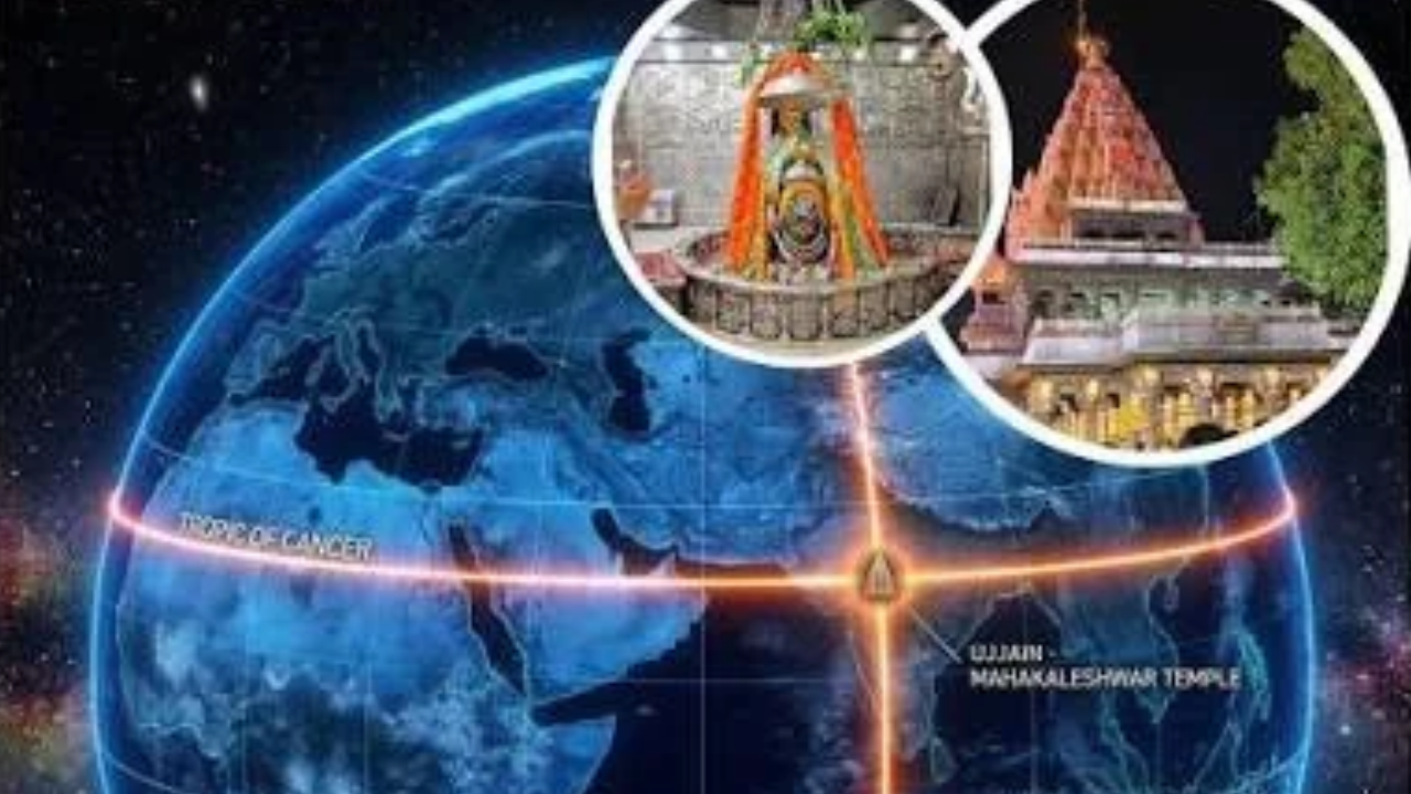
Long before the International Meridian Conference in Washington, D.C. designated the Royal Observatory at Greenwich, London, as the global zero-longitude reference in 1884, ancient and early medieval Indian astronomers operated a sophisticated geodetic framework anchored to the central meridian (Madhya Rekha) of Ujjain in present-day Madhya Pradesh. Operating more than 1,200 years prior to the standardization of Greenwich Mean Time, Indian savants utilized the Ujjain meridian—situated at geographic longitude $75^\circ 46'\text{ E}$ ($75.767^\circ\text{ E}$)—as the foundational prime meridian for computing planetary longitudes, solar and lunar eclipses, and local time differentials (desantara) across distant cities.
For civil services aspirants tracking the Atharva Examwise Current Affairs Portal, recent historiographical and mathematical evaluations highlight that Ujjain's scientific role was not merely regional. Through an intricate transcontinental transmission of scientific texts spanning from 7th-century Bhinmal to 8th-century Baghdad and 12th-century Western Europe, the longitudinal reference of Ujjain became embedded at the core of medieval Islamic and European astronomical tables. As demonstrated by historian of astronomy Raymond P. Mercier in his landmark 1985 statistical investigations published by Cambridge University Press and Vistas in Astronomy, the 12th-century Latin translations of Al-Khwarizmi's astronomical handbooks preserved the exact longitudinal reference established in 628 CE by the Indian mathematician Brahmagupta in his treatise Brahmasphutasiddhanta.
Key Facts and Exam-Relevant Data: Prelims Pointers
To streamline revision for the UPSC Civil Services Examination (CSE) and State Public Service Commissions, candidates consulting Atharva Examwise UPSC & MPPSC Study Materials can reference the following factual pointers:
Primary Reference Meridian: Ancient Sanskrit astronomical canons (siddhantas) designated the meridian passing through Ujjain ($75^\circ 46'\text{ E}$ or $75.768^\circ\text{ E}$ in Madhya Pradesh) as the zero-longitude prime meridian (Madhya Rekha) of Indian astronomy.
Foundational Sanskrit Treatise: In 628 CE, the astronomer-mathematician Brahmagupta, writing at Bhinmal, composed the Brahmasphutasiddhanta, codifying mathematical rules for planetary mean motions and longitudinal time corrections based on the Ujjain meridian.
Equatorial Intersection (Lanka and Arin): Indian mathematical geography conceptualized the Ujjain meridian as extending southward to intersect the terrestrial equator at a point termed Lanka, where day and night remain perpetually equal. In Arabic geographical and astronomical literature, Ujjayini was transcribed as Arin, and its equatorial intersection became known as Qubbat al-Ard ("Cupola of the Earth") or Qubbat Arin.
Transmission to the Abbasid Caliphate: During the 770s CE (specifically around AH 154 / 770–771 CE), an embassy from Sindh to the Baghdad court of Caliph al-Mansur introduced Sanskrit texts allied to the Brahmasphutasiddhanta and Paitamahasiddhanta. Translated into Arabic by Al-Fazari and Yaqub ibn Tariq as the Zij al-Sindhind, this transmission concurrently brought Hindu numerals, the decimal system, and trigonometric sine tables to the Islamic world.
Al-Khwarizmi and European Reception: In the 9th century CE, Persian scholar Muhammad ibn Musa al-Khwarizmi compiled his astronomical tables (Zij al-Sindhind) at Baghdad's House of Wisdom, anchoring planetary positions to the prime meridian of Arin (Ujjain). Translated into Latin in the 12th century CE in connection with scholars such as Adelard of Bath, these tables carried Ujjain's longitudinal reference directly into medieval European science.
Empirical Validation (1985): In 1985, Raymond P. Mercier applied the statistical method of least squares to pre-Copernican and Sanskrit planetary tables, proving mathematically that the mean longitudes in both Indian canons and 12th-century Latin editions of Al-Khwarizmi converged on the meridian of Ujjain.
Chronological Evolution: From Bhinmal and Ujjain to Medieval Europe
The emergence of Ujjain as the "Greenwich of Indian Astronomy" resulted from a confluence of geographical, commercial, and scientific factors. Located in Madhya Pradesh along major trade routes leading down the Narmada valley to the western port of Broach, Ujjain functioned as a premier intellectual center where classical Indian mathematical astronomy (ganita) flourished alongside observational traditions later exemplified by 18th-century observatories at Ujjain, Jaipur, Delhi, Mathura, and Varanasi.
| Historical Era | Geographic Center | Key Scholars / Institutions | Primary Text / Instrument | Scientific & Geodetic Significance |
|---|---|---|---|---|
| c. 499 CE – 6th Century CE | India (Ujjain Meridian) | Aryabhata; Varahamihira | Aryabhatiya; Pancasiddhantika | Established sidereal planetary mean motions anchored to the central meridian passing from Ujjain to equatorial Lanka. |
| 628 CE | Bhinmal & Ujjain (India) | Brahmagupta | Brahmasphutasiddhanta | Formulated a dawn-epoch planetary system and precise longitudinal correction methods referenced to Ujjain. |
| 770s CE (AH 154) | Baghdad (Abbasid Caliphate) | Kanka (Indian savant); Al-Fazari; Yaqub ibn Tariq | Zij al-Sindhind; Tarkib al-aflak | Diplomatic mission from Sindh transmitted Sanskrit astronomy, Hindu numerals, sine tables, and the Ujjain meridian to the Arab world. |
| 9th Century CE (c. 820–833 CE) | Baghdad (House of Wisdom) | Muhammad ibn Musa al-Khwarizmi | Zij al-Sindhind; Kitab Surat al-Ard | Synthesized Indian, Persian, and Greek astronomy while retaining Arin (Ujjain, $75^\circ 46'\text{ E}$) as the prime meridian for planetary tables. |
| 11th–12th Century CE | Al-Andalus (Spain) & Europe | Maslamah al-Majriti; Adelard of Bath | Latin edition of Astronomical Tables of Al-Khwarizmi | Revised in Spain and translated into Latin in the 12th century; preserved Brahmagupta's original Ujjain longitudinal reference. |
| 1884 CE | Washington, D.C. (USA) | International Meridian Conference | Greenwich Prime Meridian Resolution | Designated Greenwich, London ($0^\circ$), as the international zero-longitude standard, over 1,250 years after Brahmagupta's treatise. |
| 1985 CE | New Delhi & Southampton | Raymond P. Mercier (IAU Colloquium No. 91) | The Meridians of Reference of Indian Astronomical Canons | Applied least-squares statistical analysis to prove that Sanskrit and medieval Latin tables mathematically converge on Ujjain. |
The Sanskrit Siddhantic Foundation (499 CE – 628 CE)
In classical Sanskrit astronomical treatises, determining the true longitudinal position of the Sun, Moon, and planets required computing mean longitudes at a baseline prime meridian and then applying a longitudinal time correction proportional to the terrestrial distance between the local city and that central meridian. Both Aryabhata—whose underlying astronomical observations centered near 499 CE—in the Aryabhatiya and Varahamihira in the Pancasiddhantika anchored their planetary calculations to the central meridian passing through Ujjain and extending southward to the imaginary equatorial point of Lanka.
In 628 CE, the mathematician and astronomer Brahmagupta composed his magnum opus, the Brahmasphutasiddhanta, at Bhinmal. While certain astronomical traditions such as Ptolemy's Greek tables and parts of the Aryabhatiya utilized a noon epoch, Brahmagupta—in alignment with the Paitamahasiddhanta of the Vishnudharmottara Purana—established a dawn (sunrise) epoch referenced to the meridian of Ujjain. Because orbital mean motions change continuously over time, the choice of reference meridian and daily epoch became permanently embedded within the numerical parameters of the planetary tables.
The Abbasid Translation Movement and the Mythos of "Arin" (8th–9th Century CE)
The political consolidation of the Abbasid Caliphate in the 8th century created a major institutional conduit for the westward migration of Indian mathematical astronomy. During the reign of Caliph al-Mansur (754–775 CE), a diplomatic mission from Sindh arrived in Baghdad around AH 154 (770–771 CE), bringing a Sanskrit astronomical text closely allied to Brahmagupta's Brahmasphutasiddhanta and the Paitamahasiddhanta. Historical accounts preserved in Abraham ben Ezra's preface to Ibn al-Muthanna's commentary on Al-Khwarizmi's tables recount that an Indian savant named Kanka (or Kankah) from the city of Arin (Ujjain) instructed Arab scholars in the calculation of the seven planets, solar and lunar eclipses, declinations, rising times, and astrological houses. Working from this Sanskrit transmission, Ibrahim al-Fazari and Yaqub ibn Tariq compiled the Arabic Zij al-Sindhind and the cosmological treatise Tarkib al-aflak (composed around 777–778 CE), while simultaneously introducing Hindu numerals, the decimal system, and trigonometric sine (jya) tables to the Islamic world.
A pivotal linguistic and cartographic evolution occurred during this cross-cultural exchange, as documented in the University of Chicago Press – The History of Cartography. In Arabic orthography, the name of Ujjain was corrupted through the omission of a diacritical dot over one letter into Arin (written in Latin texts as Arin, Arim, or Arym). Because Sanskrit canons referenced both Ujjain and its equatorial intersection (Lanka) where the length of daylight equals the length of night throughout the year, Arabic geographers synthesized the concept into Qubbat al-Ard ("Cupola of the Earth") or Qubbat Arin. Adopted alongside Ptolemy's western prime meridian through the Fortunate Isles, the central meridian of Arin became a foundational coordinate axis of Islamic mathematical geography.
In the 9th century, Muhammad ibn Musa al-Khwarizmi (c. 780–850 CE), working at Baghdad's House of Wisdom, compiled his celebrated astronomical handbook, the Zij al-Sindhind, as well as his geographical treatise Kitab Surat al-Ard (833 CE). In the very introductory paragraph of his astronomical tables, Al-Khwarizmi explicitly referenced the prime meridian of Arin, reflecting his handbook's direct structural dependence on Brahmagupta's Brahmasphutasiddhanta.
Survival in 12th-Century European Latin Manuscripts
As Islamic astronomy spread westward into Al-Andalus (Spain), scholars such as Maslamah al-Majriti (c. 1008 CE) edited and adapted Al-Khwarizmi's astronomical tables. During the 12th-century renaissance of European scholarship, translators such as Adelard of Bath rendered Al-Khwarizmi's Zij into Latin. Although medieval scribes occasionally added supplementary tables for western meridians, the core planetary mean motion tables in the 12th-century Latin versions retained the original longitudinal reference of Arin—thereby preserving the scientific coordinate of Ujjain inside medieval European astronomy.
Raymond Mercier's 1985 Statistical Proof: How Modern Mathematics Verified Ujjain
For much of the 20th century, historians of astronomy debated whether classical Indian and medieval Arabic planetary tables were derived from genuine empirical observations conducted in India or were merely uncritical adaptations of Greek tables. A decisive breakthrough occurred through statistical paleogeodesy—initiated by French scholar Roger Billard in L'Astronomie Indienne (1971) and expanded by Raymond P. Mercier of Southampton University in 1985.
While Billard used computer calculations to establish the historical years when the mean parameters of Sanskrit canons best agreed with the real sky—proving the high observational accuracy of Indian texts and showing that David Pingree's non-observational chronology erred by up to 500 years—Billard had always assumed a priori that the reference meridian was Ujjain. In his 1985 investigations (The Meridians of Reference of Indian Astronomical Canons, presented at IAU Colloquium No. 91 in New Delhi, and Meridians of Reference in Pre-Copernican Tables in Vistas in Astronomy), Mercier extended Billard's method by using the statistical method of least squares to solve simultaneously for both the optimum year of observation ($t_0$) and the optimum meridian of reference ($\phi_0$, East of Greenwich).
The Mathematical Mechanism of Meridian Recovery
To extract the embedded meridian of an ancient astronomical canon, Mercier compared medieval sidereal and tropical mean longitudes across nine celestial elements—the Sun, Moon, Lunar apogee, Lunar node, Mercury, Venus, Mars, Jupiter, and Saturn—against modern ephemeris expressions recommended by the International Astronomical Union (Francou et al., 1983).
In modern celestial mechanics, true planetary longitudes $L_i$ are functions of Terrestrial Dynamical Time ($\text{TDT}$), whereas medieval linear expressions $\Lambda_i$ are functions of Universal Time ($\text{UT}$, denoted $t$) governed by the Earth's rotation. Because tidal friction gradually decelerates the Earth's rotation rate, $\text{TDT}$ differs from $\text{UT}$ by the cumulative quantity $\Delta T$ ($\text{TDT} = t + \Delta T$), which Mercier modeled using the Spencer Jones (1939) formula. Mercier defined the angular deviation $D_i(t, \phi)$ between the medieval tabular longitude and the modern ephemeris longitude for a meridian at longitude $\phi$ East of Greenwich as:
$$D_i(t, \phi) = \Lambda_i\left(t - \frac{\phi}{360}\right) - L_i(t + \Delta T)$$
Key Analytical Findings and Second-Order Implications
Mercier's least-squares optimization generated three interconnected insights that reshaped the historiography of global astronomy. First, across the Sanskrit astronomical canons from the era of Aryabhata, Varahamihira, and Brahmagupta onward, the statistically derived meridians lay firmly within central India and were clearly identifiable with the meridian of Ujjain ($75.767^\circ\text{ E}$) within statistical error bounds. This mathematical convergence confirmed that Indian siddhantas were grounded in authentic sky observations referenced to Ujjain rather than copied from Alexandrian Greek sources.
Second, Mercier's analysis revealed a profound astrophysical link between ancient Indian tables and the measurement of Earth's rotational deceleration ($\Delta T$). When examining Aryabhata's mean longitudes (observed near 499 CE), the unadjusted least-squares calculation yielded an optimum meridian of $56.98^\circ \pm 3.60^\circ\text{ E}$. Because $56.98^\circ\text{ E}$ lies $18.79^\circ$ west of Ujjain's true longitude ($75.767^\circ\text{ E}$), and an angular rotation of $18.79^\circ$ corresponds to $4,510\text{ seconds}$ of time, Mercier demonstrated that anchoring Aryabhata's observations to Ujjain yields an empirical $\Delta T$ measurement of $4,510\text{ seconds}$ for c. 499 CE. Finally, when Mercier applied the same least-squares technique to the 12th-century European Latin editions of Al-Khwarizmi's astronomical tables, the statistical regression confirmed that the tables still preserved Brahmagupta's original Ujjain meridian ($75^\circ 46'\text{ E}$) from the 628 CE Brahmasphutasiddhanta.
Why this matters for your exam preparation
For aspirants preparing for the UPSC Civil Services Examination (Prelims and Mains) and State Public Service Commission examinations (especially MPPSC), the historical trajectory of the Ujjain prime meridian integrates key syllabus areas across General Studies Paper 1 (Indian Heritage, Culture, and Physical Geography) and General Studies Paper 3 (History of Science and Technology). In recent examination cycles, UPSC has increasingly emphasized ancient India's indigenous scientific knowledge systems—spanning mathematical astronomy, geodesy, and metallurgy—requiring candidates to substantiate broad civilizational claims with precise textual and empirical evidence. By citing Brahmagupta's Brahmasphutasiddhanta (628 CE), the geographical significance of Ujjain at $75^\circ 46'\text{ E}$ (Madhya Rekha), its Arabic transformation into Arin and Qubbat al-Ard via the 8th-century Sindhind embassy to Baghdad, and Raymond Mercier's 1985 statistical verification of 12th-century European Latin manuscripts, candidates can construct authoritative Mains answers that demonstrate how ancient Indian mathematics actively shaped medieval Islamic and European scientific traditions.
Furthermore, for Preliminary Examination preparation, this topic offers high-probability factual linkages regarding chronological milestones, classical texts (Aryabhatiya, Pancasiddhantika, Brahmasphutasiddhanta, and Zij al-Sindhind), and technical distinctions such as the dawn (sunrise) epoch used by Brahmagupta versus the noon epoch employed in Ptolemaic astronomy. State Civil Services candidates in Madhya Pradesh should additionally link Ujjain's ancient role as the global prime meridian with its continuity as an astronomical hub through the 18th-century observatory (Jantar Mantar) erected by Maharaja Sawai Jai Singh II in 1734. Aspirants seeking structured revision notes, daily practice MCQs, and comprehensive foundation modules can explore the Atharva Examwise Main Portal and the Atharva Examwise Current Affairs Section to align their daily preparation with evolving competitive exam standards.